User:NotAnyoneSpecial: Difference between revisions
From sc2k-reverse
Jump to navigationJump to search
No edit summary |
No edit summary |
||
| Line 2: | Line 2: | ||
{{InfoboxTile|Name=Construction 2|TileSprite=1195.png|TileID=0xC3|ZoningType=None|Something=0xABCD}} | {{InfoboxTile|Name=Construction 2|TileSprite=1195.png|TileID=0xC3|ZoningType=None|Something=0xABCD}} | ||
==public scratchpad (needs formal writeup)== | ==public scratchpad (needs formal writeup)== | ||
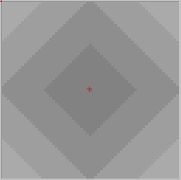
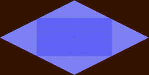
[[File:City Center MiniMap.png|thumb|City Center correctly indicated with Red Cross at 62, 62 on minimap display for Windows 3.11]] | |||
[[File:City Center Display.png|thumb|City Center displayed with onmap Land value data display from the map's actual center.]] | |||
Rubble/Radioactive = -20 | Rubble/Radioactive = -20 | ||
Big Park = +40 | Big Park = +40 | ||
Trees/SmallPark = +20 | Trees/SmallPark = +20 | ||
===Res=== | ===Res=== | ||
Residential Land Value & No zone (0046AE09) = | Residential Land Value & No zone (0046AE09) = (64-CC_Dist)/2 - ( Pollution / 5 ) - ( Crime / 3 ) + +21 for under 64 "density" + NaturalBeauty_ResCom | ||
===Com=== | ===Com=== | ||
Commercial Land Value (0046AEF9) = | Commercial Land Value (0046AEF9) = 64-CC_Dist - ( Pollution / 4 ) - ( Crime / 3 ) + (Population Density / 3) + NaturalBeauty_ResCom | ||
===Ind=== | ===Ind=== | ||
Industrial Land Value (0046AFE7) = ( | Industrial Land Value (0046AFE7) = (64-CC_Dist)/4 - ( Pollution / 16 ) - ( Crime / 4 ) + +21 for dense industry + NaturalBeauty_Ind | ||
===Crimes=== | ===Crimes=== | ||
2x2 Cell ()= Population Density- (Police Power / 2) - (Land Value / 4) + +12 for Legalized Gambling | 2x2 Cell ()= Population Density- (Police Power / 2) - (Land Value / 4) + +12 for Legalized Gambling | ||
===Pollution=== | ===Pollution=== | ||
cell = [last_cycle + traffic/5 + all 4 inside tiles RawPollution + 200 for Radioactive] average around / Pollution divisor | cell = [last_cycle + traffic/5 + all 4 inside tiles RawPollution + 200 for Radioactive] average around / Pollution divisor | ||
Revision as of 04:48, 13 March 2025
Hello world!
| Construction 2 | |
|---|---|
 | |
| TileID | 0xC3 |
| Zoning Type | None |
| Something | 0xABCD |
public scratchpad (needs formal writeup)


Rubble/Radioactive = -20 Big Park = +40 Trees/SmallPark = +20
Res
Residential Land Value & No zone (0046AE09) = (64-CC_Dist)/2 - ( Pollution / 5 ) - ( Crime / 3 ) + +21 for under 64 "density" + NaturalBeauty_ResCom
Com
Commercial Land Value (0046AEF9) = 64-CC_Dist - ( Pollution / 4 ) - ( Crime / 3 ) + (Population Density / 3) + NaturalBeauty_ResCom
Ind
Industrial Land Value (0046AFE7) = (64-CC_Dist)/4 - ( Pollution / 16 ) - ( Crime / 4 ) + +21 for dense industry + NaturalBeauty_Ind
Crimes
2x2 Cell ()= Population Density- (Police Power / 2) - (Land Value / 4) + +12 for Legalized Gambling
Pollution
cell = [last_cycle + traffic/5 + all 4 inside tiles RawPollution + 200 for Radioactive] average around / Pollution divisor